New this week, we’re offering more control for the way that you use water temperature readings in PRO maps. Plus, there’s a brand new option for viewing water clarity readings over time.
Water Clarity History
Just like the recent improvement to our water temperature map layer, we are now giving you more information on when our water clarity readings were taken. Why is this a helpful feature for trip planning? Beyond understanding how fresh the data is, you can use the slider to see the trends for how clear or murky the water is becoming over time. This can be an important factor for selecting your pattern, especially when combined with water temps.
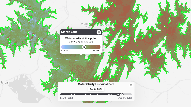
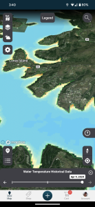
Water Temp and Clarity Date Slider In App
Speaking of water conditions, each of our date sliders have been added to the Omnia Fishing app as well as the website for PRO members. Enjoy delving in to all of the trip planning info no matter where you are.
From the app, turn on your water temperature or water clarity layers. Then tap a lake to activate the slider to view historic readings. At any time, you can tap a specific point on the map to get the exact details for the information you’ve selected.
Visit omniafishing.com/map to sign up and try the new water clarity and water temperature features. Or, download the Omnia Fishing app and start a free 7-day trial of PRO.